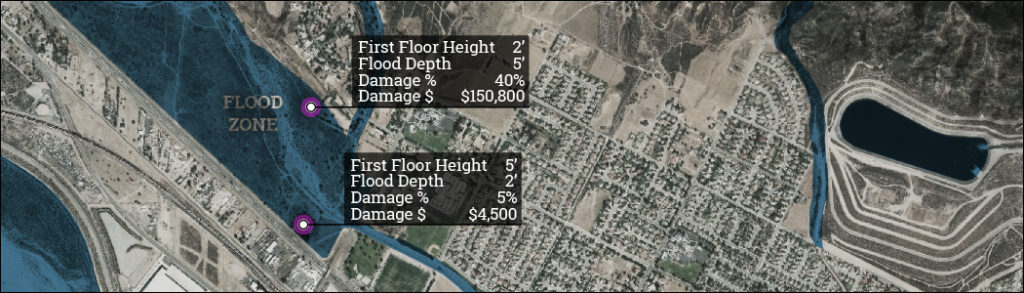
Kern Multi-Jurisdiction Hazard Mitigation Plan

2019-20 Update

Kern_County_Seal

UPDATES

5/1/2020: All RAMP interfaces have been updated to RAMP 2.0 to provide a better user experience – see the user guide link above for more information.
7/25/2019: Population Maps updated to improve population summary accuracy within municipal boundaries.

Using RAMP

The links below allow you to access each version of the Risk Assessment Mapping Platform “RAMP”. Please see the user documentation for more details on how to use the mapping applications. If you need help navigating these mapping tools, please email brian@dynamicplanning.co

RAMP Resources

The RAMP user guide details RAMP’s user interface and how to use the mapping application.

RAMP User Guide

The hazards legend provides full details for each class of hazard portrayed in RAMP and provides data sources.

Hazards Legend

The GIS data dictionary itemizes the status of each GIS data layer that will be used in the project.

GIS Data Dictionary

If you need additional help navigating these mapping tools or have any questions regarding data sources, analysis methodes, etc., please email brian@dynamicplanning.co.

Translate »