City of Benicia Open Space
Vegetative Fuels Management Plan
View the Plan!
Explore the comprehensive approach the City of Benicia is taking to enhance wildfire resilience through our Vegetative Fuels Management Plan. Delve into our innovative strategies, tailored to each unique area of our community, ensuring effective and sustainable vegetation management. Click below to access the full plan and discover how we are proactively safeguarding against wildfire risks.
LEARN MORE
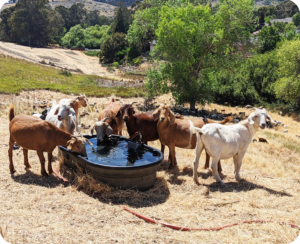
Many Open Space Areas (OSA) and lots are managed by the City of Benicia, most of which are completely or partially encircled by residential development. Open the story map below to discover where the City has employed disking and grazing over the years to mitigate wildfire risk to surrounding parcels.
About Benicia’s Open Spaces
The City of Benicia currently manages over 1,700 acres of open space, much of which borders residential areas in a transition zone known as the Wildland Urban Interface (WUI). This intersection between natural and built environment poses unique challenges to managing wildfire risk. The City of Benicia is formalizing a Defensible Space Program to reduce wildfire risk across City-owned open space areas.

Mitigation at Home
Perform Mitigation Around Your Home!
Mitigation around your home can better prepare you and your family for an unexpected emergency or disaster incident, and help you recover more quickly. Here are some resources to get you started.
Assess Your Own Risk
Using Cal OES MyHazards, type in your address to asses your risk to natural hazards including fire, earthquakes, flood, and tsunami. Learn what you should do to reduce injuries, protect your life and those of others, and reduce damage to your home and property.
Visit Ready.gov to learn about different hazards and how you can prepare your home or business for these events.
Fire Mitigation At Home
- FEMA Protect your Property from Wildfire
- CAL FIRE Defensible Space at Home
- California Fire Safe Council: Information on grants/ funding programs and community events.
- CAL FIRE Why 100′: PSA from CAL Fire with defensible space guidelines for your home.
- CAL FIRE Ready for Wildfire: CAL Fire website for preparing your home for wildfire.
- CAL Fire Ready for Wildfire (Get Ready): CAL Fire tips on defensible space, hardening your home, and fire-resistant landscapes.
- CAL Fire Ready for Wildfire (Prevention): CAL Fire “One Less Spark” wildfire prevention tips for equipment use, debris burning, campfires and more.
- Find your home’s risk factor.
PRESENTATIONS
City Council Meeting
City Council Presentation Slides 1/18/2022
Parks & Open Space Commission Meeting
HELP & HOW-TO
How to Comment Using Review PDF
- The PDF opens in a web browser. Enter as a guest (please use your full name),or sign in with your Adobe ID and password. Signing in allows you to use @ mention tags, edit or delete your comments anytime.
- Add comments to the PDF using the commenting tools. All reviewers can see your comments.
- While reviewing, you can also do the following:
- Use the @ mention to get the reviewer’s attention. Use of the @ mention sends a notification to the named reviewer.
- Filter comments based on comment status like Unread, Resolved, @ mentions, or comment author.
- Use the Options Menu to edit, mark as unread, resolve, or delete a selected comment.
- When you have finished your review, click Done. A notification is shown in Acrobat DC and an email is sent to the initiator.
Project Contacts
Benicia Fire Department
Della Olm
Management Analyst
dolm@ci.benicia.ca.us
Dynamic Planning + Science
Ethan Mobley
Project Manager
ethan@dynamicplanning.co
Dynamic Planning + Science
Brian Greer
GIS Lead
brian@dynamicplanning.co
